
Same Earth, Different Map: UN Backs More Accurate World Map
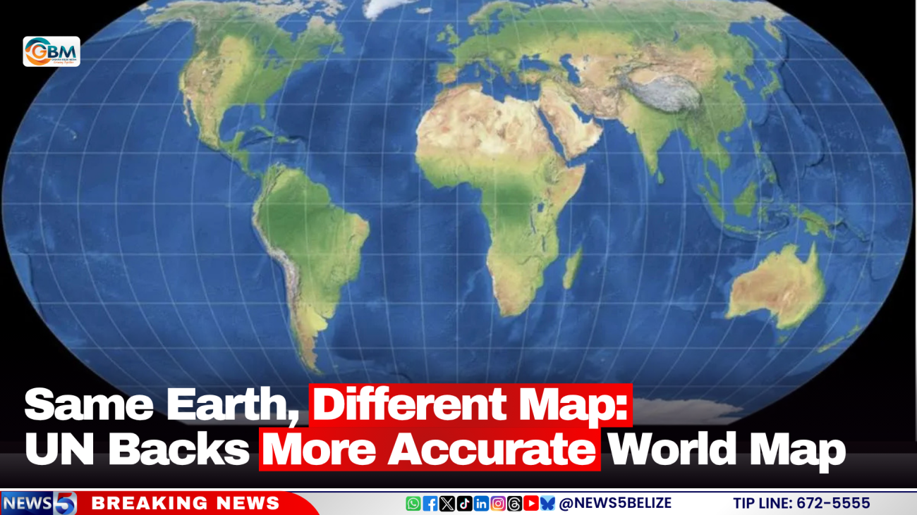
The world map familiar to generations of people could soon look different, following a United Nations decision to promote a projection that more accurately reflects the relative size of the world’s continents.
The UN General Assembly last week endorsed a resolution supporting the wider use of the Equal Earth projection, an alternative to the widely used Mercator map.
The resolution was approved by 164 countries, with the United States voting against it and six countries abstaining.
The Equal Earth projection was developed in 2018 and is designed to show the size of countries and continents more accurately, making regions like Africa appear closer to their actual size.
The difference is noticeable when Africa is compared with Greenland, which can appear similar in size on the Mercator map, despite Africa being about 14 times larger.
The Mercator projection was originally designed for navigation, but because of the way the spherical Earth is represented on a flat map, areas closer to the Equator appear smaller while regions farther north and south appear enlarged.
Countries and institutions are not required to adopt the new map immediately. Instead, it encourages governments, schools, international organisations, media and technology companies to consider more accurate representations of the world’s land masses.
The move could eventually affect what students see in classrooms as well as maps used by technology companies and other institutions. Togo, a West African country, is planning further discussions with the African Union, UNESCO and technology companies on how the resolution could be implemented.