

Guatemala Issues Guidance on “Correct Use” of National Map Including Belize
Guatemala’s Ministry of Foreign Affairs has released an official guide outlining what it calls the “correct use” of the map of Guatemala, stressing how the Belize adjacency line should be represented while the territorial dispute remains before the International Court of Justice (ICJ).
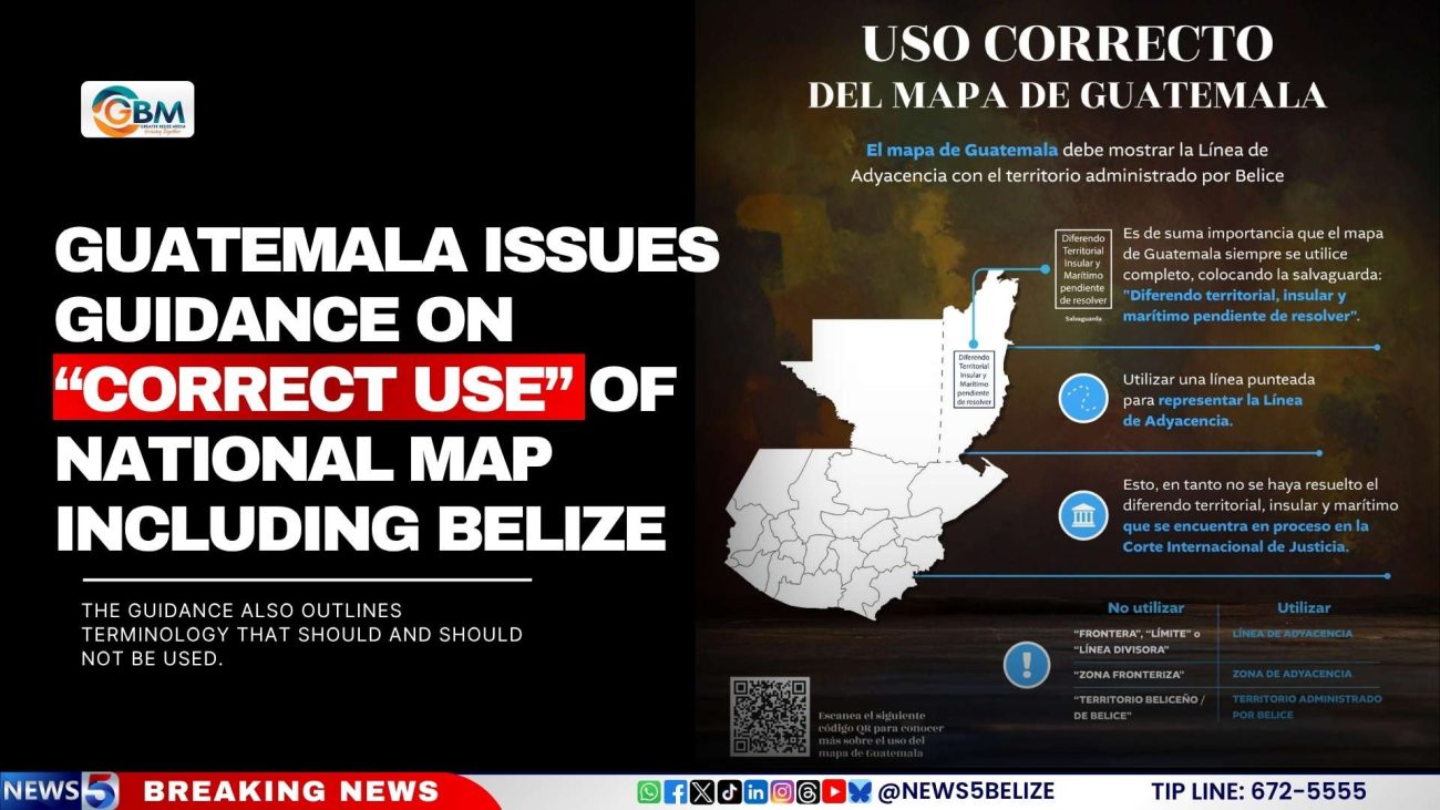
According to the ministry, all official maps of Guatemala must display the Adjacency Line separating Guatemala from the territory currently administered by Belize. The guide stresses that the map should always include a safeguard note reading: “Diferendo territorial, insular y marítimo pendiente de resolver” (“Territorial, insular, and maritime dispute pending resolution”).
The ministry instructs the public and institutions to use a dotted line to represent the Adjacency Line, clarifying that this is necessary because the territorial, insular, and maritime dispute between Guatemala and Belize has not yet been resolved and is still under consideration at the ICJ.
The guidance also outlines terminology that should and should not be used. Terms such as “frontera,” “límite,” or “línea divisora” (“border,” “limit,” “dividing line”), as well as “zona fronteriza” (“border zone”) and “territorio beliceño/de Belice” (“Belizean territory/of Belize”), should not be used. Instead, the ministry instructs that the appropriate terms are “Línea de Adyacencia,” “Zona de Adyacencia,” and “territorio administrado por Belice.”