

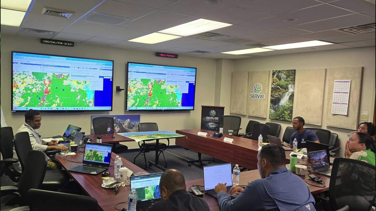
AI Mapping Tools Unveiled for Forest Monitoring
Tonight, we’re talking about cutting-edge technology meeting conservation right here in Belize. Imagine using artificial intelligence to keep an eye on our forests and mangroves from space, that’s exactly what’s happening. The University of Alabama in Huntsville has teamed up with the Belize Forest Department and the Ministry of Sustainable Development to track how our natural resources are holding up. And the good news is that Belize is leading the way in the region. Today, officials unveiled three major tools that could change how we monitor and protect our environment.
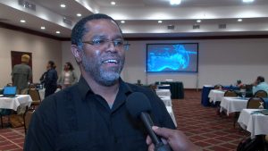
Emil Cherrington
Dr. Emil Cherrington, Research Scientist, University of Alabama
“The University of Alabama in Huntsville, we have a partnership right now with the Belize Forest Department and the Ministry of Sustainable Development, Climate Change and Solid Waste Management. We have been supporting them, backstopping them, doing different working and looking at using artificial intelligence to analyze satellite imagery over Belize’s territory, specifically looking at how mangrove cover has evolved over Belize over the last five years. I guess the good news for Belize, especially compared to other countries in the region, Belize is doing really well in terms of maintaining our natural resources. And I know that other colleagues from the Forestry Department are going to be talking about how ultimately the Government of Belize intends to benefit financially from having maintained those carbon stocks, etc.”

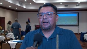
Wilbur Sabido
Wilbur Sabido, Chief Forest Officer
“So, the Forest Department has an important role to play in terms of forest monitoring and what that implies is that given the new technologies that are underused currently, we have integrated a science-driven approach with new technologies which include AI. Three significant products will be presented here today: one, a national mangrove cover map for the time period of 2020 to 2024; a fire monitoring system which gives an almost real-time result in terms of wildfires that are occurring throughout the country. And thirdly, a land use cover map for up to 2023. So all of these three products are key elements to the National Forest Monitoring System that Belize has put together under the auspices of the Belize Fund through the government’s strategic allocation project which is a system that the Forest Department manages.”
Facebook Comments