Along with the seven-point five percent salary increase, the union is also pushing for transfer grants to go up from twelve hundred to one thousand, five hundred dollars. They want the government to make sure every public officer transferred between 2021 and 2024 gets the one thousand, five hundred dollars they’re owed, as per the negotiated agreement. P.S.U. President, Dean Flowers, pointed out that these demands haven’t been met yet, and despite no budget review, a C.E.O. salary increase has been approved.
Dean Flowers, President, Public Service Union
“In essence, we’re saying to them that we want a response to that framework within twenty-one days, so that we can move ahead with the negotiations. And more specifically with the submission of proposals that are to be considered under the new CBA. So they have twenty-one days to respond to us before we go back to our membership and ask for a mandate on how we proceed. Despite the elections, the government had enough time to look at that framework and to provide us with a response. But clearly they do not prioritize public officers. They do not prioritize improving the lives and the working conditions of public officers. So they’ve dragged their feet there and now that the election is behind us and a new cabinet has been installed. We’re hoping that we will get a response within twenty-one days. We will be thereafter submitting our proposals and on the negotiations, I’m hoping we’ll then proceed and we can close those negotiations within six to twelve months at maximum. Within the framework, we’re proposing a maximum of one year of negotiations.”
The ongoing erosion of Placencia beach has sparked concern among thecommunity, leading to discussions on how to tackle the problem before the popular tourist spot loses its entire beachfront. The Ministries of Natural Resources, Sustainable Development, and Infrastructure Development recently met with Placencia residents to address the issue. News Five’s Marion Ali spoke with Brice Dial, the Placencia Village Council Secretary, and Albert Loewen, a property owner, who explained the plan to move forward. Here’s the report.
Marion Ali, Reporting
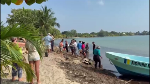
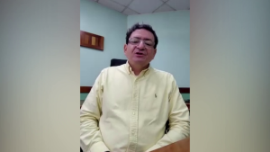
In March, several Placencia residents gathered at the beach to remove rocks that had been piled up in front of private property as a form of protection. The property owner, worried about erosion on his beachfront, had built the rock wall to preserve the area. However, environmental research shows that these rock walls cause erosion at other beachfront properties further south on the peninsula. Erosion has been a problem in Placencia for a while now. Brice Dial, Secretary of the Placencia Village Council, says that progress in one part of the area has led to problems for them in Placencia.
On the Phone: Brice Dial, Secretary, Placencia Village Council
“There’s a lack of flow of sand coming to the peninsula now, partly because of extraction of material from the South Stann Creek River and diversions to the river. There has been a diversion for pumping water, for irrigation for the banana farms. So that’s one of the issues.”
The erosion problem worsened for Placencia residents living south of the peninsula because those living to the north placed rocks on the beach in front of their homes to protect their beachfront.
On the Phone: Brice Dial
“If every single property owner along the coast is capturing sand, at some point there is going to be no sand moving down south, which is basically where we’re at right now. So that natural replenishment that used to happen isn’t happening, and we had a scientist here working along with a group called Strong Coast, and that scientist gathered data of the entire peninsula. And there was a meeting, I think it’s going on two weeks now. He said in the meeting, he’s a specialist with coastal erosion. He said that approach is not something that is recommended by the experts. It just fixes the immediate problem in front of a property, but overall it causes more damage than good.”
A Professor of Civil and Environmental Engineering at the University of South Florida recently conducted a project in Placencia. She also weighed in on the erosion issue and shared Dr. Ping Wang’s suggestions from a community meeting on the topic.
Maya Trotz
Maya Trotz, Professor, Environmental Engineering, University of South Florida
“The question for here is, I think, do you go through that process of doing the rocks and the sea walls and then learning two decades later that you know, there is another way to do this? Or do you start sort of testing and doing some pilots on what beach nourishment might look like, coupled with many other things, so coupled with beach nourishment, but maybe coupled with adding more vegetation, so that you have some sort of dunes on the beach front that can also help to hold the sand. Many people here would like to see more literal forests and just the natural vegetation come back and then on the seaside, if you nourish the beach – so this is like bringing your sand onto the beach and then it over time will naturally form with a structure that would stay there for longer. You’ll continue to have to nourish, but it’ll be a couple years maybe, and then maybe, you know, Dr. Wang was talking this morning when we passed the Placencia airport, that that has a lot of rocks. It’s important infrastructure, but also that might be an area where you could cover the rocks and make that sort of a dune.”
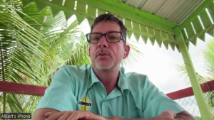
Albert Loewen lives in the northern end, in Maya Beach. He came up with a plan to solve the issue.
Albert Loewen
Albert Loewen, Property Owner, Maya Beach
“I already asked somebody this week if I could start with my beach if I was allowed to barge in some sand to replenish my beach, and they said that’d be a good idea to actually do a trial on my beach at my cost to try barge in some sand and see how replenishment works. So I think that’s the approach and then we try to get government involved because again, Placencia generates a lot of income for Belize. The initial issue that Placencia had, they needed about $200,000 to fix their problem that they have right now, so they’ll have to spend about a half a million dollars to start with or more, but once we get it fixed once, we will probably only have to spend about a hundred thousand a year to keep the replenishment stable in on, on the, on the Placencia beach.”
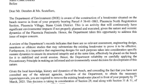
Loewen estimates it will cost about a quarter million dollars to dredge material from the sea and fill the eroded beach. He believes this is a better option than placing rock walls along the northern end of the peninsula, which would eventually leave the entire south of Placencia without a beach. However, a recent meeting between the village council and relevant ministries has resulted in a plan. According to a press release, they are committed to addressing any human-induced factors contributing to the problem. They also acknowledge the impact of climate change on Placencia. The plan includes enforcing environmental regulations strictly against non-compliance and increasing vigilance through frequent inspections. Additionally, they will formally notify the Cabinet of the concerns raised by all stakeholders and the proposed actions by agencies to address the issue. Marion Ali for News Five.
A village council is putting its foot down in Orange Walk after the Lands Advisory Committee began taking steps to subdivide a nature park in the community. Earlier this month, the San Jose Nuevo Palmar Village council wrote to, Chairman of the Committee, Wincy Perez, strongly opposing the subdivision of the Siibal Yum Nature Park. In the letter, Village Chairman Orlando Ayuso explains that over twenty thousand dollars has been invested into the renovation of the park, which has become a popular spot for leisure and recreational activities in the community. We spoke with Ayuso today to hear why the council believes the park has become an integral part of the community.
Orlando Ayuso
Orlando Ayuso, Chairman, San Jose Nuevo Palmar
“The state of the park, right now’s a clean park, a usable space. If you go to our social media page, we just had a very successful Easter egg hunt. And when we came by asking for the vote for the second term, we promised the people in that area, you’re gonna have a park. We’re gonna clean this up. People will stop dumping garbage. You will stop smelling the stench of rotten carcasses because you used to dump dead dogs, dead chickens, people who are running poultry shops to dump the feathers and things over there. It was hard to monitor because of the lack of resources and finances. And as usual, I, as a chairperson, took the lead. Two of my members, my vice chairman and one of my counselors, went on to offer themselves for election for Lands Committee. And they won. They won because they’re very good leaders, so people look at them as somebody who could lead. And it just so happened that now they’re on that side that one of it’s not them that wanna subdivided. It’s a little group of people guiding them into subdividing this park. So that is how we arrive at where we are today, that day that the Palmar Village Council is asking the Lands Committee to not do that subdivision because it is already an established part. It’s a pity. It’s a pity because on that side of the village, these people haven’t gotten much, and this is the first meaningful thing that they’re getting from any group that has been governing the village and children are using that playground already. They go there to play, it’s a safe environment. In the afternoons, people go and walk around it and work out because most people work out on Boundary Road, which is a busy street. So it’s safer for them to go one street behind to the park. We know as Siibal Yum Nature Park and they some ride their bicycles around, some walk around. And we are trying to keep it natural because you wanna create a nature park. We’re planting more trees. We have put in a few park benches because it’s community-based, so people have been donating those benches were donated by villagers, not by any group specifically, but by villagers. So if this was to be taken away, then they’re taking away the only recreational area that side of the village has.”
San Jose Palmar has a unique history that shapes how land is distributed in the community. Descendants of the village can use the land freely, with the government acting as a trustee and the Lands Advisory Committee deciding on the distribution. Recently, the Palmar Village Council sent a letter to Orange Walk East Area Representative Kevin Bernard, expressing their concerns about the potential subdivision of the land. They emphasized that the community has greatly benefited from the park and stressed that any decisions about the land should be made transparently.
Orlando Ayuso
Orlando Ayuso, Chairman, San Jose Nuevo Palmar
“The subdivision, yes, it should be given to the descendants, but at the end of the day, they have also agreed that they’re gonna sell two land, two of those land to make back monies. do understand that there is some financial issue between the last outgoing Lands Committee and the present lands committee now, but that is something for them to solve. That is a descendant issue, a land advisory committee issue. Apart from that, as Village Council Chairman, my part is to protect parks and playgrounds, which I am given that right under the Village Council Act. And I wanna see this park remain because I do believe in green areas. I wanna see this park remain because I do having green areas because it is beneficial for the community. I do understand from those twelve lots that will come out from that park, two will be sold. And they already have the bias for those supposedly we don’t. And the question we need that descendants need to raise to their committee, who are going to be the people getting this land cause we hear a lot of rumors out there, which I prefer not to repeat because like I say, it’s rumors, but they need to ask the question, who will be the ones getting these lands? It is heartbreaking. The figure quoted in the letter of twenty thousand is not physically cash. People have contributed their time in cleaning. People have contributed fuel, some have contributed the benches, they have contributed food for the workers. So all of that, the time invested, the work invested is what adds up to that. It was never like twenty thousand in hand we are investing. The lands committee did spend a bit of finance there because they’re the ones that have the more finance in the village council. So we had to piggyback on them for that at the beginning. Truckloads of garbage came out from there that had to be dumped. Bulldozer had to be put in to start cleaning up the area. So a lot of work has gone in and people from the community have gone there to put in physical labor. So people feel that they belong. This is a part of them. This is they’re giving back to the community and they’re creating something for everybody. Nobody’s taking ownership on this. It’s something for everyone to enjoy.”
One area that will need significant attention under Minister Dr. Louis Zabaneh’s leadership is Indigenous Affairs. The Government of Belize and Maya communities in Toledo are working together to implement the 2015 CCJ Consent Order. Just six days ago, the CCJ held its latest monitoring hearing. Today, Minister Zabaneh emphasized that genuine consultations will be crucial to meeting the deadlines set by the order.
Louis Zabaneh
Dr. Louis Zabaneh, Minister of Indigenous Affairs
“It is very important that whoever we are working with, whatever part of government we are in, something I learnt and utilized when I was privileged to be in the ministry of education, is genuine consultations. This means you are not just sitting and listening and giving lip service to meeting with people. You are in a real sense incorporating their points of view, their interest in the final solution. That is the only way you will have sustainable solutions. I felt that is was important along with my colleagues Minister Doctor Osmond Martinez, Minister Oscar Requena, as we met with the Toledo Alcaldes Association and with the Julian Cho Society that we made that clear at the beginning, we listened carefully to their positions and I think we left with a very good feeling that whatever gaps there might has been due to a previous misunderstanding, we want to close those gaps to go forward and try to meet our deadlines from that consent order in 2015.”
The Easter holiday is just around the corner, and many are in the final stages of their travel preparations. As the public gears up to embark on various land and sea journeys, the Belize Police Department is reminding everyone to exercise extreme caution this season. Last year, Belize observed a record year for fatal road traffic accidents, and holidays are an exceptionally dangerous time to be travelling on the motorways. Commissioner of Police Chester Williams shares some tips on how to achieve a fun and safe holiday this year.
Chester Williams, Commissioner of Police
“At this time of the year we know that the length season is one that many Belizeans would take for granted, and it has troubled us for many years. We see an increase in loss of lives, not just on the highways, but on the waterways. And so we normally encourage our people to exercise extreme caution when using the highways. Try to drive within speed limits. Do not drive recklessly. Stay on your side of the road. And those who goes through waterways always try to take somebody with you. Don’t go alone because sometimes you go into these rivers, water is so cold, you catch a cramp. If nobody’s there to assist you, you might just submerge and never resurface. And so again, try to go with somebody and do not go into water is too deep that you will not be able to stand with your head above above the water. And again, the police and the police department will be working very closely with department of Transport countrywide on highways to make sure that we do our part to mitigate. The the occurrences of traffic accidents on the highways around this time.”
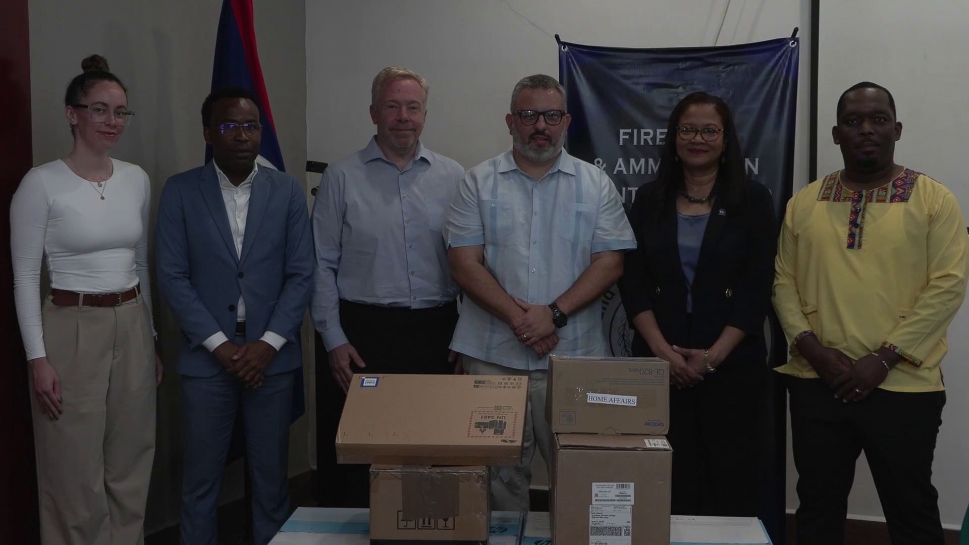
Belize’s Ministry of Home Affairs is taking significant steps to manage small arms and light weapons, addressing both national security and regional stability. This initiative is crucial as the country faces challenges related to the proliferation of illicit firearms, which fuel violence and crime. Collaborating with CARICOM IMPACS and the Mines Advisory Group (MAG), Belize is working to enhance its capabilities in controlling and securing these weapons. CARICOM IMPACS supports regional efforts to combat the illicit trade of small arms, while MAG provides technical assistance and training to improve stockpile management. Together, these partnerships aim to reduce armed violence and promote safety across Belize and the Caribbean.
Kareem Musa
Kareem Musa, Minister of Home Affairs
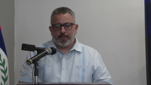
“The Government of Belize, through the Ministry of Home Affairs and the Firearms and Ammunition Control Board recognizes that the management of small arms and light weapons is not solely a matter of national security. It is a cornerstone of regional stability, rule of law, and international cooperation. As such, we have taken deliberate and strategic action to ensure that our national frameworks align with key instruments such as the CARICOM Declaration on Small Arms and Light weapons, the Arms Trade Treaty, and the United Nations Program of Actions on Small Arms and Light Weapons. This newly integrated digital system, supported by CARICOM Impacts and the Mines Advisory Group is more than a technological innovation, it is a policy instrument that enables us to strengthen compliance with the modular small arms control implementation compendium and international ammunitions technical guidelines standards.”
The US government is playing a pivotal role in managing small arms and light weapons to enhance regional stability in Belize and the wider Caribbean. Collaborating with CARICOM IMPACS and the Mines Advisory Group (MAG), the US is providing crucial support to control the spread of illicit firearms, which fuel violence and crime. Through initiatives like the Conventional Weapons Destruction (CWD) program, the US is helping to secure weapon stockpiles, train local authorities, and destroy excess arms. These efforts are vital for reducing armed violence and promoting safety across Belize and the Caribbean.
David Hodge
David Hodge, Charge d’Affairs, USEmbassy
“The proliferation of small arms and ammunition undermines regional stability, fuels organized crime and drives illegal immigration, challenges that directly impact the safety of both Belizeans and Americans. In tackling these issues we are advancing our own national security and, as Secretary Rubio has noted, the security of our shared hemisphere. The United States is committed to addressing these challenges head-on, providing the Belize Firearms Licensing Board with this digital firearms registry system is a crucial step in this fight.”
“Today marks a significant milestone in Belize’s ongoing journey to modernize and digitize its firearms governance architecture and strengthen its firearms registration and licensing system. On January second of this year, the Firearms and Ammunition Control Board of Belize formally requested CARICOM Impact’s support to address critical gaps in Belize’s firearms control architecture. In response, our team at CARICOM Impacts, in collaboration with the Mines Advisory Group, and with the general support of the United States government rapidly mobilized technical, operational, and strategic resources. Within days, consultations were held and by March, a comprehensive support package was mobilized and today, just over three months later, we have transitioned from request to delivery.”
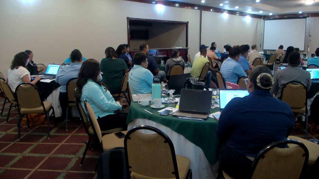
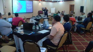
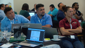
This morning, the Coastal Zone Management Authority and Institute hosted its second Belize Sustainable Ocean Plan Geo-Spatial workshop. This three-day event gathers stakeholders to discuss priority ocean protection areas using specific data collection tools. It is a continuation of the Multi-sector Marine Spatial Planning Workshop hosted in 2024. News Five’s Britey Gordon has more details on the event.
Britney Gordon, Reporting
Belize’s ocean space is crucial for the survival of many sectors, including tourism, fishing, and conservation. Protecting these shared waters is essential. Today, the Coastal Zone Management Authority and Institute started a geospatial workshop to help stakeholders identify priority areas for protection and understand how ocean space is used.
Samir Rosado
Samir Rosado, MSP Lead, CZMAI
“The purpose of the workshop is to look at the use and application of two decision support tools that we’re using in our MSP development process. The two tools that we’re looking at are namely Sea Sketch and Marxan. Now Sea Sketch is more of a data collection tool as well as a planning tool so it’s multifaceted. Sea Sketch is what we’re utilizing to capture information from the general public, from users of our ocean space to figure out exactly where our priority areas are for the various usages.”
The team wants to make sure that areas used for recreation and religious activities are included in the data collection, so people aren’t displaced. Data collection tools are crucial for this. At the workshop, there’s a team from the University of California, Santa Barbara, who developed the Sea Sketch Application. Senior Fellow Will McClintock explains how it works.
Will McClintock
Will McClintock, National Center for Ecological Analysis & Synthesis, UC Santa Barbara
“It’s a tool that allows users who can be non-technical users, average stakeholders with no real expertise in, in mapping to map their values in terms of what areas in the ocean they value and how they use it, and then what areas they would like to protect and protected areas or biodiversity protection zones. So my team is here to teach folks how to use this tool and ultimately design biodiversity protection zones that are meeting science and policy guidelines for ecosystem protection while minimizing the displacement of users of ocean space.”
Sea Sketch is accessible to anyone with internet access and lets users add data to a map, showing popular areas and their uses. Another tool at the workshop is Marxan, which helps with marine spatial planning. Kate Longley-Wood, Marine Spatial Planning Science Manager at The Nature Conservancy, explains that the team is figuring out how to integrate the collected data into their technical tools.
Kate Longley-Wood
Kate Longley-Wood, Marines Spatial Planning Science Manager, T.N.C.
“Marxan is a tool that lets users put in information about priorities for conservation. So Marxan can let users say, okay, I want a marine protected area network that represents. It’s thirty percent of coral reefs and maybe also integrates other stakeholder concerns, like avoiding areas that might have high levels of conflict or high levels of cost. And so this program is really good at taking really complex criteria and turning it into outputs that people can then understand and comment on. And so it’s a really great process that is used for Marie spatial planning processes around the world.”
Marxan can be used to provide potential solutions to complex conservation questions, such as where a country should place a marine protected area. It also works alongside tools such as Sea Sketch to generate input data results. Rosado explains that by continuing work such as this, Belize is on its way to meeting the thirty percent ocean space as biodiversity protection zone goal.
Samir Rosado
“That thirty percent goal is tied to two milestones that are time-bound deliverables under the blue bond agreement. Recently in November fourth of last year, we met the milestone four goal, which is to designate twenty-five percent of Belize’s ocean space as a biodiversity protection zone. So that was met in November of last year. So we are currently at twenty point zero five percent of our ocean space designated the remainder of the timeframe, or I should say the next milestone is due for November fourth of next year. And so we are working towards identifying and designating the remaining up to forty percent.”
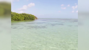
Less than a week after News Five aired concerns from San Pedro residents about the Cayo Rosario development, the Ministry of Infrastructure Development and Housing (M.I.D.H.) has issued a stop order to halt construction. On Friday, M.I.D.H. informed Daniel Kalenov, a director with the Cayo Rosario Development Group, about the stop order after a site visit on April ninth revealed that several buildings, including an entrance pier, were built without the necessary permits. In a letter to Kalenov, Derick Calles, Director of Building Control at the Central Building Authority, stated that the order will remain in effect until all required permits are obtained from the Central Building Authority and other relevant authorities for all structures and construction activities on the site. On April eighth, a public meeting in San Pedro saw dozens of residents, business owners, and environmental organizations voicing their opposition to the controversial development, which plans to build up to forty over-water structures in the Hol Chan Marine Reserve. Residents are particularly concerned about the piles driven into the sea to support a pier and an over-the-water concrete structure. The model currently in place represents what the other thirty-nine structures would entail. Citizens argue that interfering with the seabed to drive so many piles will permanently drive away the numerous types of fish that feed in the immediate area. Cayo Rosario is a six-acre island located about six miles west of San Pedro Town.