

Hurricane Erin Brings Dangerous Surf to U.S. Coast
Hurricane Erin, the first Atlantic hurricane of 2025, is expected to generate life-threatening surf and rip currents along the U.S. East Coast this week.
According to the National Hurricane Center in Miami, the storm will not make landfall in the U.S. or nearby island nations, but its impact will still be felt.
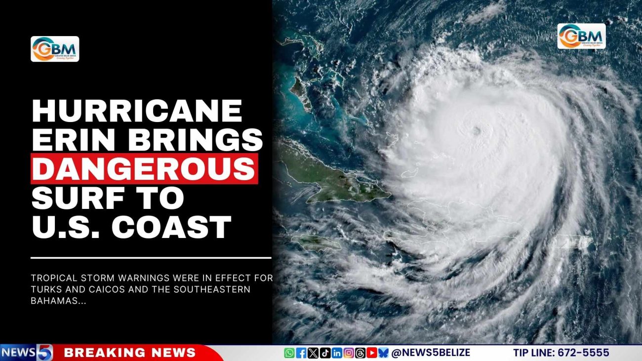
As of 11 a.m. EDT Monday, Erin had maximum sustained winds of 140 miles per hour, making it a powerful Category 4 storm. The hurricane’s centre was about 110 miles north of Grand Turk Island in Turks and Caicos and roughly 880 miles south-southeast of Cape Hatteras, North Carolina, moving west-northwest at 10 mph.
Forecasters said Erin will remain a “dangerous major hurricane” through midweek. Hurricane-force winds extended up to 80 miles from the centre, while tropical-storm-force winds stretched outward 230 miles. Tropical storm warnings were in effect for Turks and Caicos and the southeastern Bahamas, while the central Bahamas remained under a watch.

Erin rapidly intensified over the weekend, reaching Category 5 strength on Saturday before weakening to Category 3 early Sunday and then regaining strength later that day.
Facebook Comments